On this page
Symbol Gallery: Browse MIL-STD-2525 Symbols
All available military symbols are present in the gallery. From there they can be selected and placed on the map.
Overview
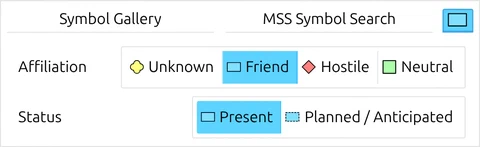
 Clicking on this button opens the Symbol Gallery.
Areas and groups
All basic symbols are stored in areas and subgroups under the ‘Symbol Gallery’ tab. These areas are available:
| Area | Content |
|---|---|
| My Favorites | Right-click a symbol and choose Add to My Favorites. This is the only way in — the gallery’s own + button does nothing in map.army |
| Formations | 1-point symbols that define formations |
| Equipment and Installations | 1-point symbols for vehicles, weapons and facilities |
| Tactical Graphics | Multipoint symbols for tactical representations |
| Function-Specific Symbols | 1- and multi-point symbols for special functions (emergency, peacekeeping, etc.) |
| Metoc | 1- and multi-point symbols for the display of weather information |
| Civil Symbols | Police, fire and civil-protection symbols — only in Extended Work Mode |
The last row is the one to know about: Civil Symbols appears only when Work Mode is set to Extended. In International mode the gallery has six areas; switch to Extended under General Options and a seventh appears.
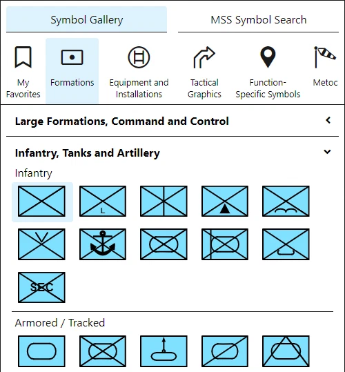
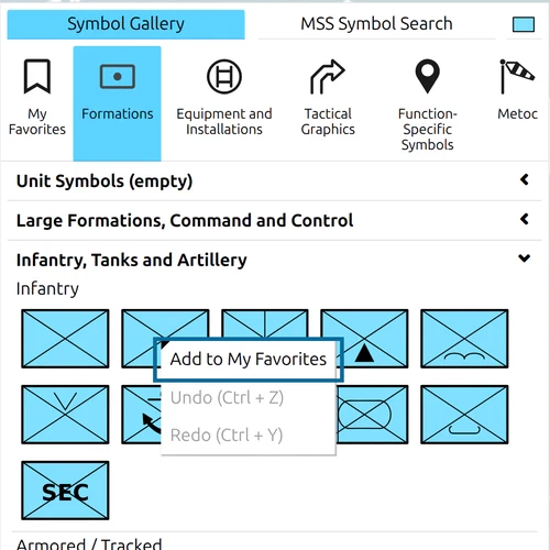
Within each area, the icons are divided into groups to make them easier to find. If a symbol is highlighted, it can be placed on the map with one click.
Search Symbols
Under the tab MSS Symbol Search you can find a base symbol by its name. The names are those of the military standard (MIL-STD-2525), in the language of the app: with the app set to German you search for Infanterie, not infantry — an English term then finds nothing. Switch the language under Options → General → Language if you know a symbol only by its English name.
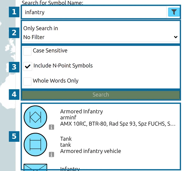
- Type part of the name into Search for Symbol Name:. The funnel button next to the field shows or hides the filter settings (2 and 3).
- Only Search in limits the search to one branch of the symbol library; No Filter searches all of it. The list follows the current Work Mode and language.
- Case Sensitive and Whole Words Only narrow the match; both are off by default. Include N-Point Symbols — on by default — also lists tactical graphics drawn with several points (lines, areas, arrows); untick it to see only 1-point symbols such as units and equipment.
- Click Search or press Enter. After a search the button stays greyed out until you change the text or an option — Enter still searches again.
- Each result shows the symbol with its short name, abbreviation and alternative names. Point at the i icon for the full name and the symbol code. Click a result to select it; it can then be placed on the map with one click.
Tips for finding a military symbol fast:
- Search in your interface language, with short distinctive words: phase line, boundary, objective, range fan, not a full designation such as phase line alpha.
- The search matches names, short names, abbreviations and alternative names. It does not search by symbol code (SIDC); the code is shown under the i icon of a result.
- The result list stops at about 50 entries, without a message. If a general word such as obstacle does not show the symbol you want, type a more specific term.
- When you know the branch, open it in the gallery tree instead, or limit the search with Only Search in.
Symbols with an emoji
The group Symbol with Emoji Support, in the area Function-Specific Symbols, holds ordinary military symbols — space, air, unit, equipment, installation and sea symbols — that show an emoji inside their frame. It is available in both Work Modes.
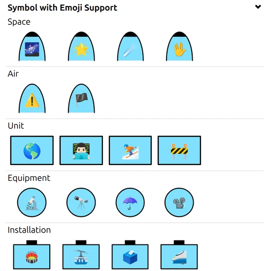
The emoji is simply text in the symbol’s Icon Text modifier: map.army draws the first emoji it finds there, centred in the icon area. To choose a different one, open the symbol in the Symbol Editor and type or paste the emoji into that field — there is no emoji picker. The field holds up to 31 characters.
Symbol standard versions
map.army draws MIL-STD-2525C, the US standard that is closely aligned with NATO’s APP-6. Exchange with APP-6-based systems runs through NVG.
| Question | Answer |
|---|---|
| Which standard does map.army draw? | MIL-STD-2525C, one symbol library |
| APP-6, MIL-STD-2525D / E? | Not drawn; exchange with APP-6-based systems through NVG |
| Work Mode International | MIL-STD-2525C symbols and modifiers, plus a few map.army extensions such as generic graphics |
| Work Mode Extended | adds country-specific symbols and modifiers, today the Swiss set — see Work modes |
| MSS library version | the release of the symbol catalogue a file was made with; used to write files for older releases, not to choose a standard |
What is not in the public app:
- MIL-STD-2525D / 2525E / APP-6D / APP-6E-exclusive symbols (e.g. Advance to Contact from newer NATO publications) — not available; map.army draws MIL-STD-2525C.
- APP-6(C)-only categories that are not in MIL-STD-2525 (for example CIMIC — Civil-Military Cooperation, Combat Support — Manoeuvre Enhancement) — not available; there is no separate APP-6 symbol library.
- Custom symbology beyond the standards (unit crests, fictional formations, non-military emblems) — see the image-layer workaround in Layers → Import Overlays — Image layers for custom graphics.
If you cannot find a symbol you expect:
- Switch Options → General → Work Mode to Extended — the Swiss country-specific symbols and additional modifiers are only visible in Extended.
- Use the MSS Symbol Search tab with the MIL-STD-2525 name in the language the app is set to, rather than alternative names from local doctrines.
- For symbols outside the supported standard, Icon Extension Modifiers can attach additional indicator icons to an existing unit, equipment or installation symbol — see Symbols → Symbol Editor. For full custom symbology, contact gs-soft AG via the contact form.
Last updated: