On this page
Map tools: coordinate search and measurement options
This section describes the settings for tools used in maps in map.army.
Overview
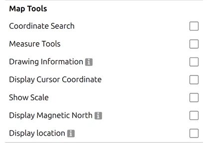
Here you can change settings for map tools.
Coordinate search
 A search button is displayed at the bottom left, via which coordinates can be entered.
The coordinate search supports several reference systems.
| Sign | Meaning |
|---|---|
| ’ ' | Spaces are used as separators between elements |
| ‘.’ | The point is used as a decimal separator |
The following units are supported:
- m, km, ft, yd, mi
- Degrees are supported as angle units: ‘°’, ‘deg’ oder ‘degree’
If the unit is omitted, the unit of the reference system is used.
Examples:
- WGS84: 7.45 46.95 = 7.45° 46.95° = 7.45 deg 46.95
- GARS: 006BC27
- MGRS: 32TLT 82 km 340 m = 32TLT 82000034
- UTM: 32N 382km 5201km
- BNG: TQ38 = TQ 30km 80km
Measure Tools
 Two buttons are displayed at the bottom left with which distances or areas can be measured.
Drawing Information

Shows running feedback while you draw — length, bearing and the like as a tactical graphic takes shape, rather than only once it is finished. Useful when a graphic has to hit a given distance or bearing.
Display Cursor Coordinate

The position of the cursor is shown at the bottom left. The coordinates depend on the selected coordinate grid.
Show Scale

A scale is displayed at the bottom left, which shows a defined distance depending on the selected zoom level.
Display Magnetic North

Draws a magnetic-north indicator on the map alongside grid north, so you can read the difference between them directly. That difference is the magnetic declination, and what to do with it is covered in Magnetic declination.
Display location

Shows your own position on the map, from the device the browser is running on. The browser asks your permission the first time; if you decline, nothing appears and the setting looks broken — that refusal is remembered by the browser, not by map.army.
If your device does not support the feature, the row is not shown at all — it is removed from the Options panel rather than greyed out. An absent Display location row and a switched-off one are therefore different things.
Support needs more than location: map.army requires the device to expose orientation sensors as well as a location service, because the display shows which way you are facing and not only where you are. That is why the row commonly appears on a phone and is missing on a laptop that can otherwise locate itself perfectly well — the laptop has no compass.
Last updated: