On this page
Map coordinate system settings in map.army
This section describes the settings for the coordinate systems in map.army.
Overview
Here you can select the coordinate system and define your settings.
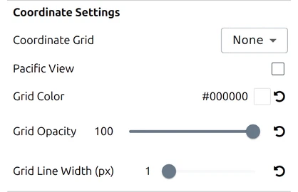
Coordinate Grid

The coordinate grid that is placed over the map is selected from the list. Available systems:
The list is given here in the order the dropdown shows it.
| System | Coverage | Best for |
|---|---|---|
| None | — | No overlay |
| WGS84 | Global | General-purpose lat/long |
| GARS | Global | Coarse area reference |
| MGRS | Global | NATO tactical planning |
| UTM | Global | Long-distance navigation |
| BNG | UK only | British Ordnance Survey maps |
| LV03 | CH only | Swiss national survey, the older frame |
| LV95 | CH only | Swiss national survey, the current frame |
| SLD99 | Sri Lanka only | Sri Lankan national survey |
| Kandawala | Sri Lanka only | Older Sri Lankan datum, for legacy sheets |
| Hexagonal Grid | Global | Wargaming and area-of-effect overlays |
Each system is described in detail in the chapter ‘Map / Coordinate Grid’.
Hexagonal Grid settings
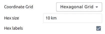
Hexagonal Grid is one of the eleven Coordinate Grid values above, not a setting of its own — you reach it by choosing it in that dropdown, and a grid of six-sided cells is drawn over the map.
Choosing it adds two further rows beneath the dropdown. They appear only while the hexagonal grid is selected, which is why the group looks shorter with any other grid:
Hex size
Defines the distance between the parallel side lines of the hexagon. Enter it with a unit, for example 4 km.
Hex labels
The hexagons are numbered with columns and rows. The zero point lies on the equator on the prime meridian.
Pacific View

Re-centres the map on the Pacific so it is not split down the middle of the ocean. It lives in this group because it changes how the coordinate frame is laid out, not what the map looks like. What it is for, and when you need it, is covered in Pacific View.
Grid Color

The colour for the coordinate grid and the hexagon grid can be defined in a user-dialog.
Grid Opacity

Sets how solid the coordinate grid and the hexagon grid are drawn, from 0 (invisible) to 100 (fully solid). The default is 100.
Grid Line Width

The line width for the coordinate grid and the hexagon grid can be set here, from 1 to 10 pixels in half-pixel steps. The default is 1 pixel.
Reference Lines
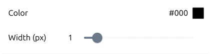
Reference lines are the lines that connect a 1-point symbol to its true position when the symbol has been offset from it — the app describes them as the “reference lines of 1-point symbols (formations, installations, …)”. They get their own Color and Width (px) so they can be made discreet, or deliberately visible.
You will see them most when Decluster Symbols is on, since that is what offsets symbols from their positions in the first place — see Symbol format.
Last updated: