On this page
Safety Distance Zones (SDZ) for live-fire planning
A Safety Distance Zone (SDZ) is the ground area that must be kept clear around a firing position, because a round can reach it — directly, or after a ricochet. map.army can draw one for you from a saved weapon type and keep it attached to the symbol that represents the firing position.
What an SDZ is, and what this tool is not
Range rings answer how far can this weapon reach. A safety distance zone answers a harder question: which ground do I have to clear. The two are not the same shape, because a danger zone accounts for rounds that do not stop where they were aimed — a ricochet area extends the hazard well beyond the impact area, and a vertical hazard defines how high the danger extends.
Switching the zone on
The SDZ controls are not a separate panel. They live inside the Point List — the View and edit graphic’s coordinates panel — so a zone is always tied to one symbol on the map.
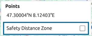
Until you tick Safety Distance Zone, that is the only SDZ control the panel shows:
The built-in Saved Types
map.army ships five weapon types in the Saved Type list, plus a Custom… entry that is selected whenever the current values match none of them:
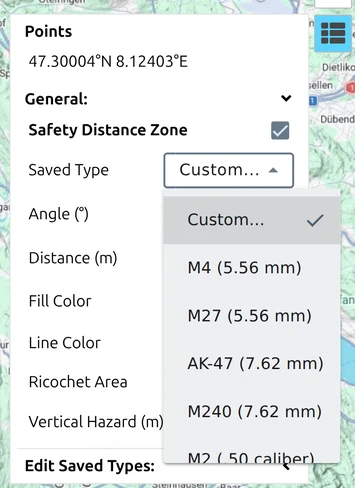
| Saved Type | Max distance | Ricochet distance | Vertical hazard |
|---|---|---|---|
| M4 (5.56 mm) | 3437 m | 2029 m | 325 m |
| M27 (5.56 mm) | 3437 m | 2029 m | 325 m |
| AK-47 (7.62 mm) | 4100 m | 4073 m | 706 m |
| M240 (7.62 mm) | 4100 m | 4073 m | 706 m |
| M2 (.50 caliber) | 6500 m | 5211 m | 901 m |
Two things in that table are worth pausing on. The ricochet distance for the 7.62 mm types is almost the full maximum distance — 4073 m against a 4100 m maximum. And the vertical hazard grows faster than the ground distance as calibre increases: the .50 calibre type reaches 901 m of altitude. If you are planning anything that flies, that number matters more than the footprint on the map.
Drawing a zone
- Place the symbol that represents the firing position, or select one that is already there.
- Open the Point List from the main window. See The Point List for the panel itself.
- Tick Safety Distance Zone.
- Pick a Saved Type, or leave Custom… and enter your own values.
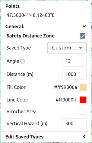
Every value is editable: Angle (°), Distance (m), Fill Color, Line Color, Ricochet Area and Vertical Hazard (m). A new zone starts at an angle of 12°, a distance of 1000 m and a vertical hazard of 300 m.
Ricochet Area is a tick box, not a value. Its own settings — length, area, start angle and end angle — appear only once it is ticked, which is what gives the drawn zone its fan shape rather than a plain circle.
The zone is drawn as a decoration on the map rather than as an ordinary tactical graphic, so it follows the symbol it belongs to.
Saving and sharing your own Saved Types
The five built-in types are a starting point, not a fixed list. Under Edit Saved Types: you can add the current zone to the list, remove one from it, export the saved types to a file, and import a set back. That is how a unit distributes an agreed set of weapon parameters to everyone planning on the same exercise.
Use it when your national figures differ from the generic ones above — agree the values once, export them, and hand the file out, rather than having every planner retype ballistic data.
What is not carried
A zone is a map decoration attached to a symbol. It is not MilX symbology, so do not assume it survives every route out of the application the way a tactical graphic does — check the result when you export or share, and see What survives a save or a share.
If the zone has to reach someone who is not using map.army, the reliable route is a PDF or image export, where it is drawn into the output like the rest of the map.
Where to go next
- The Point List — the panel the zone controls live in.
- Range rings — for weapon reach rather than a danger area.
- Measure distances and areas — to check a zone against real ground.