On this page
Measure Distance, Area and Bearing on the Map
Measure a distance of a route or an area to observe within map.army.
The measurement tools are 2D only — they have no equivalent in the 3D view.
The measurement tools are switched on under Options → Map Settings → Map Tools, alongside the on-map readouts — see Map tool settings.
Overview
map.army supports the measurement of distances and areas in the metric system as well as in the imperial units:
Activate Measurement Functions
The measurements tools are deactivated by default. Follow these steps to activate within the web application:
Open the ‘Options’ menu

Scroll to the ‘Map Settings’ and activate the ‘Measure Tools’ check box

The ‘Measure Tools’ for distance and area are displayed in the bottom left corner of the main window
Measure Distance
The distance measurement displays the distance between two points. In case of measurement of a route with multiple points the tool displays the distance of the sections as well as the overall distance. In addition, the bearing between the two points is displayed.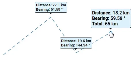
To start measuring a distance:
Press the ‘Measure distance’ button (button turns blue)

Click onto the map to set the starting point
Every click will add a point for measurement
Double click to end the measurement (pressing ‘Esc’, ‘Space’ or right click are also supported to exit the measurement)
Measure Area
The measurement of an area calculates and displays the area between three or more points on the map.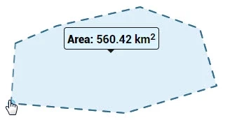
To start measuring an area:
Press the ‘Measure area’ button (button turns blue)

Click onto the map to set the starting point
Every click will add a point for measurement
Double click to end the measurement (pressing ‘Esc’, ‘Space’ or right click are also supported to exit the measurement)
Supported Units
Distance measurements support the metric system, the imperial system, and nautical miles (NM) for aeronautical and maritime use. The unit is set by Distance Unit under Options → Unit Settings. The same setting drives areas as well as distances — there is no separate unit for area.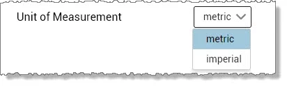
Bearings are reported twice — once from true north and once from magnetic north, one above the other. There is no setting to pick one, because you always get both; the magnetic figure is the true bearing corrected by the WMM-2025 declination at the start point of the segment. See Magnetic declination.
The Angular Unit setting chooses only the units those bearings are written in — degrees or NATO mils (6400 to a full circle; the app’s own label for this value reads Milliradian (NATO), which is not accurate). It does not change which north they are measured from.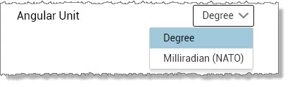
Terrain Tool — Cursor Elevation
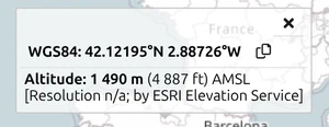
The Terrain Tool shows the ground elevation at the cursor position as you move over the map. Elevation is reported in metres or feet according to the Distance Unit setting.
The displayed elevation is AMSL (Above Mean Sea Level) — i.e. orthometric height referenced to the geoid (Earth Gravity Model), not GPS-style ellipsoidal height. This matters for aeronautical and surveying work where AMSL is the standard reference. Elevation is fetched from the Esri ArcGIS elevation service rather than computed in the app, so it needs a working connection and its accuracy is whatever that service provides for the area. Expect metre-scale uncertainty, more of it in steep terrain.
For symbol-level elevation (the altitude shown for a placed point symbol), the same AMSL reference applies.
Last updated: