On this page
Coordinate Search: Navigate the Map by WGS84, MGRS & More
This article shows you how to use the coordinate search function.
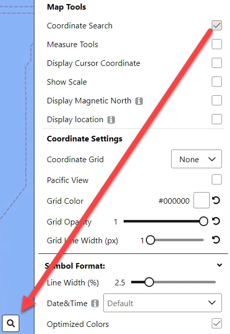
Coordinate Search is switched on under Options → Map Settings → Map Tools — see Map tool settings.
Information from the Coordinate Search

Coordinate search supports multiple reference systems.
’ ’ - space is supported as separator between elements
‘.’ - dot is the decimal separator
The following units are supported: m, km, ft, yd, mi;
Degrees are supported as Angular units: ‘°’, ‘deg’ or ‘degree’
(If the unit is omitted, the default unit of the reference system is used)
Examples:
WGS84: 46.95°N 7.45°E = 46.95N 7.45E = 46.95 7.45 = 46.95° 7.45° = 46.95 deg 7.45 deg
GARS: 006BC27
MGRS: 32TLT 82 km 340 m = 32TLT 82000034
UTM: 32N 382km 5201km
BNG: TQ38 = TQ 30km 80km
How to enable the Coordinate Search function
Click on the options button.

Scroll down until you find the Coordinate Search option and click into the white square to select it.

The Coordinate Search function is now available in the bottom left corner.
How to use the Coordinate Search function
Click on the Coordinates search on map button.

Click into the white textbox and write the coordinates.
Possible coordinate types for the searcher:Short name Full name Example WGS84 World Geodetic System 1984 46.95°N 7.45°E = 46.95N 7.45E = 46.95 7.45 = 46.95° 7.45° = 46.95 deg 7.45 deg GARS Global Area Reference System GARS: 006BC27 MGRS Military Grid Reference System MGRS: 32TLT 82 km 340 m = 32TLT 82000034 UTM Universal Transverse Mercator 32N 382km 5201km BNG British National Grid TQ38 = TQ 30km 80km Click on the green magnifying glass icon for the search.

Worked example
Searched on this coordinates: 46.95°N 7.45°E
Result: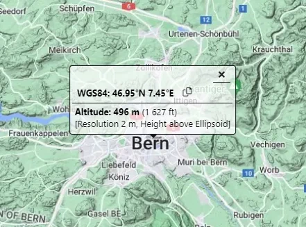
Last updated: