On this page
Export and Save a MilX Overlay as .milxlyz File
MilX layers that you have created can be saved locally with this function.
Overview
The file has the extension .milxlyz. In the case of individual layers, the layer name is used as the file name; in the case of several layers, the file is called LayerCollection.milxlyz.
Vector and image layers are not saved.
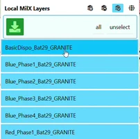
Save Layers
To save one or more layers, follow these steps:
| Step | Remark |
|---|---|
 | Click Layers to open the Layers menu, then Open Layer-Manager. |
 | Click Save as MilX — the third icon on the group header. Every layer of the group is selected. |
| Click a row to leave that layer out, or click it again to take it back in. | |
 | Click the green button Save selected Overlays (MilX Layer). |
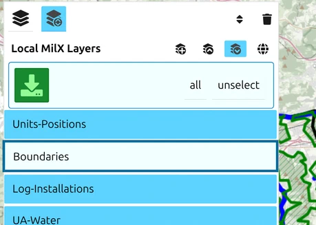
The layers are saved in your local download directory.
If you have loaded vector or image layers, these will not be exported with the MilX layers.
File format: always zipped .milxlyz
map.army saves MilX layers as the zipped .milxlyz every time — there is no setting to choose another format. Uncompressed .milxly files can still be loaded (for example from other MilX tools); they open like any .milxlyz. The KML target always produces a zipped .kmz, and NVG always a plain file.
Undo and recovery — save MilX often

map.army has Undo and Redo buttons in the bottom-right corner, and they cover more than deletions: deleting a symbol, moving one, editing its modifiers, moving one to another layer, and deleting a whole MilX layer all go onto the undo history — a deleted MilX layer comes back with its symbols, though not in its original position in the stack. Renaming a layer does not go onto the history, and neither do Track layers or vector and image layers, which are deleted outright. The full list is on Keyboard shortcuts.
Undo is still not a substitute for saving. It does not survive a reload, and a reload loses your layers outright — so treat the Save MilX action above as your “save the document” workflow:
- Save frequently. A complete MilX export takes seconds; keep dated copies in your download directory.
- Before a risky edit (large delete, layer merge, work-mode switch) — save first.
- A saved
.milxlyzcan always be re-imported as a fresh layer if the in-app state becomes corrupted or unsaveable.
Export as KML / KMZ for Google Earth
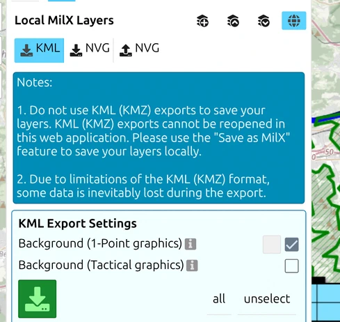
map.army can also export layers as KML or KMZ for Google Earth or ESRI Earth. That copy is a one-way snapshot — it cannot be loaded back as military symbols — so it is covered on its own page: Export a tactical map as KML or KMZ.
Reading polygon vertex coordinates
To get the WGS84 coordinates of every vertex of a polygon or multi-point symbol drawn in map.army, export the containing layer to KML or GeoJSON and open the resulting file in any text editor. Vertex coordinates appear in the file as:
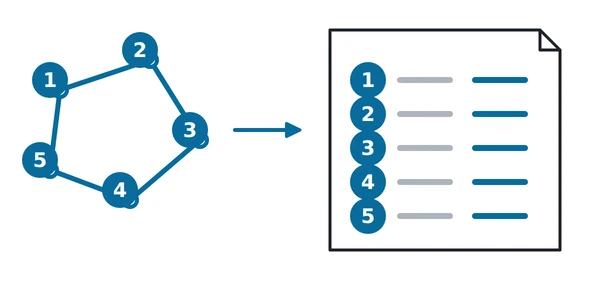
In the diagram: 1 to 5 mark the vertices of the polygon; each numbered row in the file holds that vertex as one coordinate pair.
- KML —
<coordinates>element inside<Polygon>/<LineString>, onelon,lat,alttriple per vertex. - GeoJSON —
coordinatesarray inside eachFeature.geometry, one[lon, lat]pair per vertex.
For tactical graphics with many vertices, exporting to GeoJSON gives the cleanest machine-readable form. The vertex coordinates cannot currently be read directly inside map.army’s UI — the export-then-read workflow is the supported path.
Cross-browser save workaround

If the green Save selected Overlays (MilX Layer) button does not respond in your current browser — a sporadic issue seen on certain Chrome + macOS combinations — you can transfer your layers to a working browser via a MilX Share:
- In the failing browser, create a MilX Share of your layers via Layers → Share Military Map → Create New MilX Share (see How to create a share).
- Copy the share link.
- Open the share link in a different browser (e.g. Firefox or Edge).
- From the working browser, save the layers to
.milxlyznormally.
This is a workaround for an in-progress UI bug. If you hit this regularly, report the symptom plus your browser / OS version via the contact form so it can be reproduced and fixed.
Working with very large MilX layer collections
.milxlyz files with many hundreds of symbols or many layers can hit two practical limits:
- Failure to load — a layer collection that grows over months may accumulate empty layers and metadata that exceed the loader’s working buffers. Symptom: the file refuses to open and the app shows a load error.
- Slow editing — even when the file loads, painting and modifier edits can become sluggish.
Mitigations:
- Periodically clean up empty layers — delete layers that hold zero symbols in the Layer-Manager (see The Layers panel and Layer-Manager).
- Split very large operations into multiple files — for example one
.milxlyzper phase / per unit / per sector. - For a layer collection that already fails to load, save your local copy and contact us via the contact form — we can manually trim the file as a one-off recovery.
Exporting MilX in an older format version
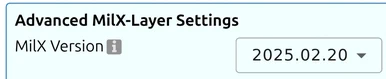
When you need to exchange a layer with a system that expects an older MilX format version — for example KADAS Albireo, or another MIL-STD-2525 consumer pinned to a specific MilX version — open the layer-management dialog and set the target version in MilX-Layer Advanced Settings (under Options → General) before exporting. The export then writes the layer in the requested MilX schema.
map.army can write older MilX versions for export but always reads the current version on import — round-tripping through an older format may drop attributes that exist in the newer schema.
There is a long list of selectable target versions, so pick the one the receiving system actually names rather than the nearest-looking number. If you do not know it, export the current version first and only downgrade when the other system rejects the file.
Choose the coordinate system for the exported file

The same advanced settings let you choose which coordinate reference system the exported MilX file is written in, rather than always using the app’s default:
| Setting | Use it when |
|---|---|
| Default | Normal exchange between map.army users. Leave it here unless you have a reason not to. |
| WGS84 | The receiving system expects plain latitude and longitude — the most portable choice. |
| Swiss LV03 | Working with Swiss national data or a system built around the Swiss grid. |
| UTM | The receiving system works in UTM zones. |
Coordinate reference system just means the frame the numbers are measured in. The symbols do not move on the ground — only the way their positions are written into the file changes. Pick what the other system asks for; if nobody has told you, Default is right.
Last updated: