On this page
Notifications, Downloads and Project Limits
Where map.army tells you what happened — messages, version information and downloads — and what it does when a project grows close to its limits.
The Message & Info Center
The i button in the bottom-right corner of the map is the Message & Info Center. Messages that do not need an answer straight away — a layer that could not be loaded or saved, a hint about your location, news about a shared map, a file being saved — are collected here instead of interrupting your work.
- A number on the button shows how many messages are waiting. Its colour follows the most serious one: red for an error, amber for a warning, blue for information.
- Click the button to open the list, titled Notifications. Each message shows the time it arrived, a title and the text.
- The bin next to a message removes it; the bin in the list header, Remove all messages (mark as read), empties the list. There is no separate “read” state — removing a message is how you mark it as read.
- The list is not kept when you reload the app. Read anything important before you do.
Links: About, Documentation, Contact, Version
Under the messages — or on their own when there are none — the Message & Info Center shows a row of links:

| Link | Opens |
|---|---|
| About | the map.army product page, in a new tab |
| Documentation | this documentation, in a new tab, in the language the app is set to |
| Contact | a contact form to gs-soft AG |
| Version | the version information — see below |
| © Map Data: … | the provider of the base map currently shown |
Version information
Version shows which release of the app and of its services you are running — the first thing to quote when you report a problem:
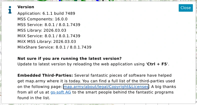
The first line, Application, is the app version and build. The lines below it name the versions of the symbol and MilX services the app talks to. If you are not sure you have the latest release, reload the app with Ctrl + F5 — see Update map.army. The link at the bottom lists the third-party software the app is built on.
Downloads
How a file reaches you depends on how many files one action produces:
- One file — for example Download layers as a MilX file in the Layers panel — is handed to the browser at once and lands wherever your browser saves downloads. A message "… is being created and saved" appears in the Message & Info Center.
- Several files at once — for example an export with its georeference files — open a small Download files panel at the bottom right, with one button per file. Click each button to download that file; its icon turns into a green tick. The bin clears the list, and the panel disappears once every file has been downloaded. The list is not kept across a reload.
If you chose a destination folder when exporting (Chrome and Edge), the files are written straight into that folder instead, and the Download files panel is not used. A file whose name already exists there gets a time stamp added to its name. See Create an Export.
Project limits
The MilX service that saves your layers sets three limits: how many layers a project may have, how many graphics a layer may hold, and how many points one graphic may have. map.army warns you in the Layers panel as you approach them:
- Amber — above 75 % of a limit. You can keep working.
- Red — over the limit. A layer or graphic over its limit cannot be saved.
The warning names the limit and lists the layers or graphics concerned; click an entry to jump to it. Layer rows show their current count against the limit in brackets.
Remove empty layers
When a project has used more than 75 % of its layer limit and at least one layer holds no graphics, the warning offers a Remove empty layers button. It deletes every layer that contains no graphics, in one step and without asking for confirmation — check the list first if you keep empty layers on purpose as placeholders.
Very large projects
Above about 6,000 military symbols in one project, map.army warns once that performance may suffer, and from then on it loads new layers with their symbols hidden. Use the Show / Hide switch of a layer to display its symbols. See Performance for how to keep large projects responsive.